INTERDISCIPLINARY ACTIVITY
Author: Daniela Crizantema Nane, „Constantin Parfene” School, Vaslui, Romania
Title – My school
School subjects - Physics, Mathematics, History, Art, Geography, Technology
Class level: 6th grade (13 year- olds)
Time: 2-4 hours
Short Description
The students were divided into five groups and they had to carry out a project entitled ‘My School’ for the accomplishment of which they had specific tasks that used competences developed by several disciplines: Physics, Mathematics, History, Art, Geography and Technology. For the presentation of the project the students used the applications: PPT, QR code, Book creator, PicCollage.
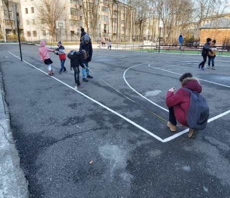
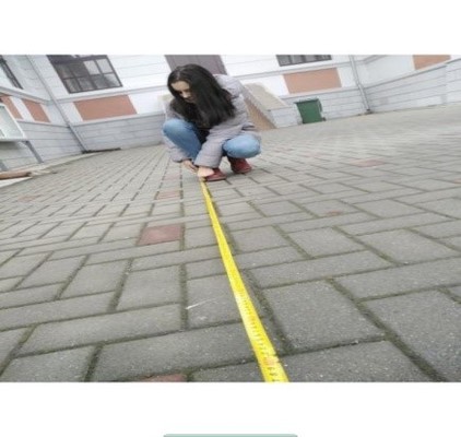
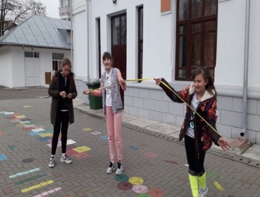
Physics: measuring the different areas of the school yard, making the table with experimental data
Mathematics: calculation of the perimeter and the area, representation on a convenient scale of the measured areas
Geography: Using the Google Maps app to locate the school and identify the neighbours according to the main cardinal points
History: searching for information about the school's past and about the spiritual patron Contantin Parfene (school website, local museum, national archives, school library)
Arts: making a drawing or a model school, taking pictures
Technology: selection of collected materials, presentation of the project using different apps
Tags – PPT, QR code, Bookcreator, PicCollage
Introduction (Brief description of lesson and its aims)
The lesson aims to develop the transversal key competences of the students in the 6th grade (aged 13) in the field of sciences, art, history, technology by using the outdoor learning methodology.
The lesson is a model of creative application of the outdoor learning methodology for the following school subjects: Physics, Mathematics, History, Art, Geography and Technology.
The lesson contributes to the development of the teachers' skills to create an active learning environment by using the outdoor learning methodology.
Learning Objectives
Students will be able to:
- use the measuring instruments for length, measure the dimensions of the schoolyard, make the experimental data table, calculate the perimeter and the area, identify the sources of errors, use the appropriate units of measurement to express the results of the measurements;
- identify the position of the school on the map
- establish the neighbours of the school using the cardinal points
- draw the shape of the measured terrain and calculate the representation scale
- search, select and process relevant information about the history of the school using various sources
- use different applications for the realization and presentation of the project.
Process
Students studied the materials about the school's history at the town's museum and in the national archives. All the information found was processed and used in the presentation of the project. The students measured the different areas of the school yard, entered the data in tables, chose convenient units of measurement and calculated the perimeter and area. They also drew, on the scale, the measured surfaces, identified the sources of errors. They made the correspondence between the position of the school and the location shown on the Google map, establishing the geographical coordinates (latitude, longitude) as well as the neighbours (by reference to the cardinal points). The students took pictures during the outdoor activities which they inserted in the project presentation. Some students have drawn the school or made a model school out of paper. The students learned new applications (QR code, Book creator, PicCollage) that they used in the realization and presentation of the project with the topic ‘My School’.
Tools & Equipment
- roulette, smart phone, video projector, computer, internet, paper, colored pencils
Useful Links
Conclusions
- The students had the opportunity to carry out their research activity for the realization of the project entitled ‘My School’ in the open air and outside the classroom.
- Students collaborated in carrying out the tasks, shared their responsibilities, worked in a team and developed communication skills, very useful when presenting and carrying out the project tasks.
- The materials made by the students were well thought out, the information was carefully selected and structured.
- The teacher thought of an activity based on things learned at different school disciplines, but used in another context and in an environment outside the classroom (in the school yard, at the museum building, the national archive and in the house).
- The teacher established the lesson plan and told the students the working tasks, as well as the aspects that will be considered in the final product evaluation- the project titled ‘My School’


