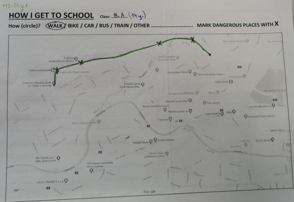
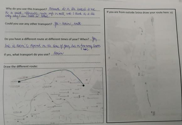
Prior to the Herzele meeting the different delegations had to create their school maps and routes.
Every student was asked how (s)he gets to school (which means of transportation) and why (s)he chooses this means of transportation.
The way to school was marked on a topographical map.
Examples of maps
Other examples of mobility maps can be found on the students' portfolio. See this link as an example.
Afterwards a document with the most common routes and the mobility statistics was created.
Example:
Mobility map INS Antoni Pous.pdf