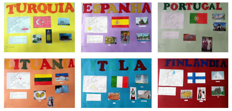
Cultural Identity Maps: Students will create identity maps of the origins of their country, language, coat of arms, flag, the national anthem.Students will familiarize with their cultural identity and know about European cultural heritage.
When preparing their identity maps, students will learn about the partner schools, towns and countries.By using the Google Maps our students wander through the streets of every partner city, see and understand other cultures in the comfort of their classrooms.
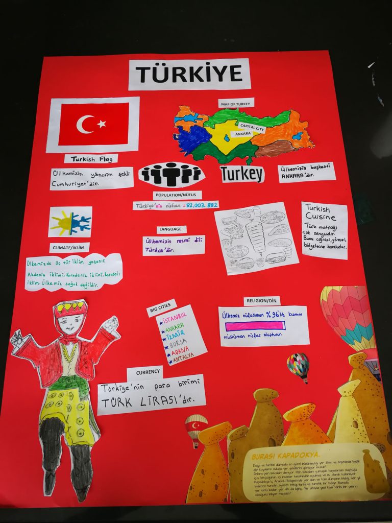
Identity maps from Turkey…
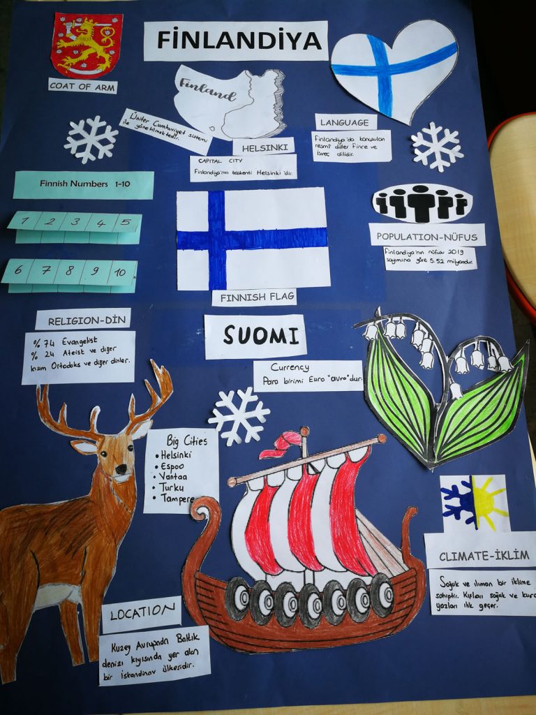
Students of Aşağı Çıyanlı Ş. Ahmet Birkaç İlkokulu, Turkey, started the activity in groups by doing a research on the net about the origins, languages, flags, national anthems and coat of flags of countries. It was a sample of collaboration and communication activity. First, they did research and collected the related information of the target country, then they wrote the related informaton on the papers to display on the maps. By using Google Maps, students learnt about the location, capital and big cities of the countries on the map. They also looked for what climate and population the countries have along with the religion. Moreover they learn about how to say the numbers from 1 to 10 in each language of 5 countries. After that they prepared the illustrations for the posters such as cultural symbols, flags and coat of arms. By doing this activity, students familiarized with cultural identity of countries and European Cultural Heritage. They not only familiarized with partner schools but also their country as well.
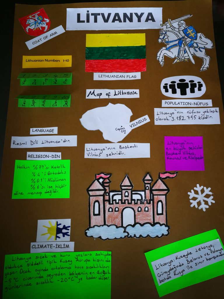
Identity maps by Lithuania…


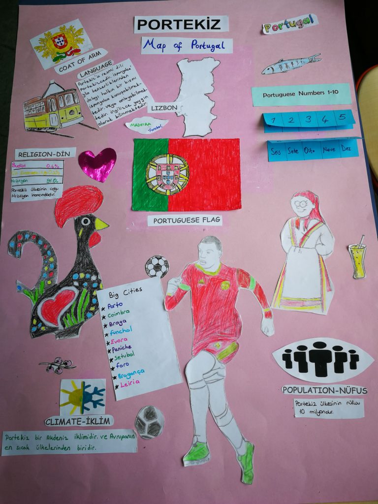
EB1/PE da Marinheira [Portugal] Cultural Identity Maps
At EB1/PE da Marinheira, in Portugal, since the beginning of the project, students in groups researched and registered in the ICT class some data about each participating country. They researched images, location, currency, language, population, flag and other subjects of interest to each country. Then, in their curricular class, they produced posters that were presented to the other students. This was a way of working in groups, promoting planning, collaboration and communication.
Then, in the ICT class with the help of the teacher, the 4th grade class prepared a presentation on Prezi with the information collected.
If you are having trouble viewing the Prezi, please click HERE.
As a way to complement the work already done, once again with the help of the ICT teacher, students researched partner schools using Google Earth and created a project.
To access the project, click HERE.
-------
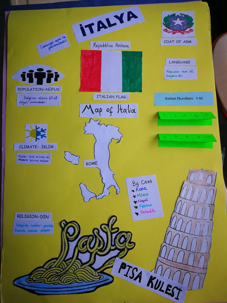
Identity maps from Italy
During October and november 2019, at the beginning of the project, 4th and 5th classes IC Giovanni Pascoli students, started to search information on the member states of the Erasmus + project Learning4Tomorrow.
Divided into groups, they first searched individually the material, than shared it with other students and chose what to include in their work.
Students prepared posters and multimedia works and presented them to their classes.
It was interesting to discover dishes and traditions, historical news and geographical aspects of each individual state.
Curiosity, collaboration, willingness to learn have been the driving force behind this activity that has led students to be builders of their knowledge.
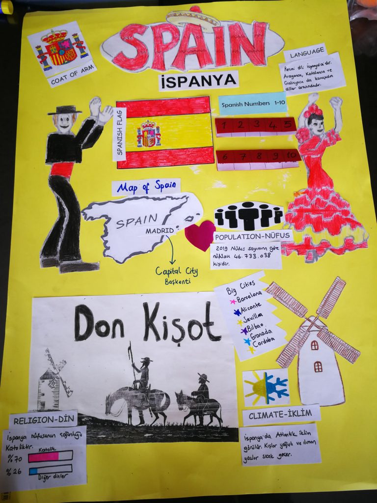
Identity maps from Spain
For several months, CEIP Maestro Juan de Ávila, have been collecting information about the different countries that are part of the project 4C’s: Learning 4 Tomorrow. Due to the pandemis suffered in Spain, quite severe, they have done the activity during the month of November. The situation is better now and they have done these books and posters that they present in this video. This project has been done by students in class with their teachers.
https://gopro.com/v/nr10eQ5PJbk3Z
Identity Maps from Finland