The Port-Miou underground river is one of the largest underground rivers in Europe. It collects the waters of the Huveaune river and the southern part of the Sainte-Baume massif and flows into the sea at a depth of several metres in the eponymous calanque to the west of the town of Cassis. It is a major geological and speleological object that bears witness to the history of the Mediterranean Sea.
Case_StudySummary_Eng.pdf
Part 1: Karst
Steps :
1. The pupils must write a summary in English in groups of 4 from the video produced by CD13 with Bruno Arfib on karst and karst phenomena. (student work in French)
Maxence Luka Adam Julian Les eaux souterraines dans les massifs calcaires cotiers mediteraneens.pdf
2. CLIL lesson GW1 to be completed in full
Objectives of the first part :
Pupils should be able to identify some common karst features (e.g. lapiaz, doline, cave...)
Students should have understood that karst phenomena are linked to a chemical balance involving 3 compartments of the biosphere: limestone (lithosphere), water (hydrosphere) and carbon dioxide (atmosphere).
Part 2: The underground river of Port-Miou
Steps :
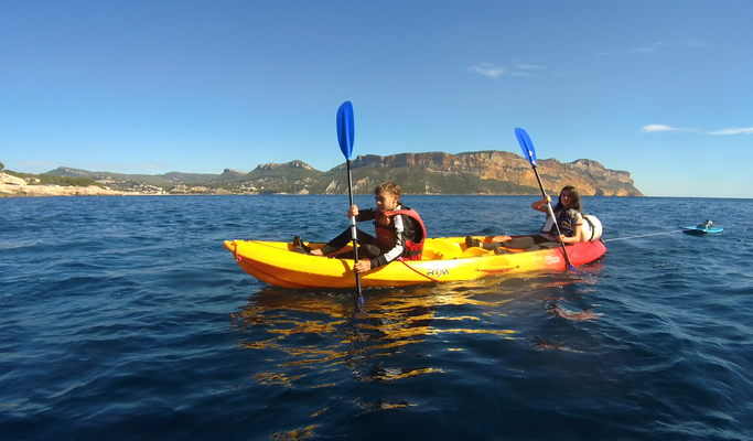
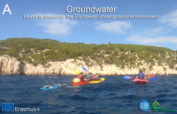
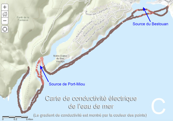
1. In the field: Observation of limestone (sedimentary rock/strates/fossils), Identification of karst phenomena (cf. part 1), observation and measurement of conductivity of sea water and "griffons" (springs), Identification of water paths in relation to tectonic constraints (faults) and karst digging.
2. CLIL lesson GW2 to be completed in full
On the edumed website
Objectives of the second part :
The pupils are now able to deal with real phenomena. They have identified karst phenomena and water paths in the field.
Pupils are able to draw a limnigram from the project data and identify the arrival of rainwater. Which percolates down to the water table.
Limestone is an aquifer, knowledge of the basic distribution of flow zones: vadose, epiphreatic, saturated, water table and piezometric level.
The water resource in the karst is important but subject to human activity. Identify the consequences of climate change and the use of the resource.
Part 3: l’Esprit sourcier
Steps :
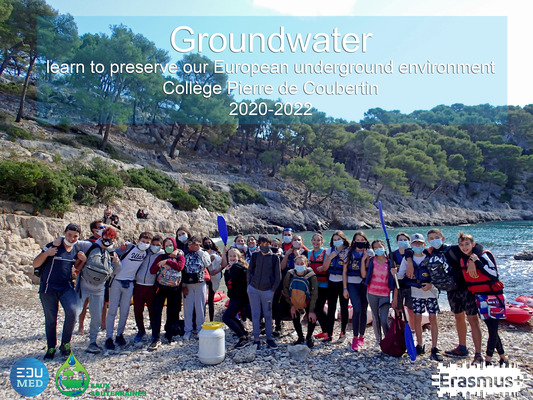
1. As part of the project "Groundwater: learn to preserve the European undergroud environment", the students designed an instrument that could geolocate the electrical conductivity of water. They called it the « l’esprit sourcier" (a « sourcier" is a legendary character who can find water with a Y-shaped stick). They used it to map the coastal area between Cassis and the calanque of Port-Pin. This project was submitted to the CGénial science competition organised by the eponymous organisation and the ministerial programme "Sciences à l'école". After winning the regional competition, they also won the first prize for a middle school at the national level. A delegation of 3 students was received in Paris in July 2021, they were able to present their work and their ERASMUS+ project on this occasion.
article_Schlumberger.pdf
2. The « Esprit sourcier" data is available for download in a format readable by the online application "tectoglob3D" : https://www.pedagogie.ac-nice.fr/svt/productions/tectoglob3d/
Data_EspritSourcier.zip
Tutorial : how to use tectoglob3D to read the data ?
Tutorial_Tectoglob3D.pdf
Objectives:
Students are able to design, build and implement a technological object based on the use of microcontrollers.
Students understand that the electrical conductivity of water is related to its ionic charge. They are able to distinguish between fresh and salt water and have an idea of the average conductivity values of each.
Part 4: Effects of climate change on access to drinking water in karst coastal areas
Steps :
As part of the examination (Oral-DNB), students are required to reflect on and produce a 5-minute scientific oral on :
1. on the history of the digging of the underground river of Port-Miou linked to the Messinian episode.
2. The rock paintings in the Cosquer cave illustrate the relationship between climate change and eustatic sea level variations.
Objectives:
Students are able to demonstrate that the water from the karst underwater spring of Port-Miou is brackish because its electrical conductivity is high. It is unfit for consumption.
The students were able to demonstrate that it is the rising sea level that is responsible for the deep contamination of karst groundwater by salt.
Pupils are able to explain that climate change leads to marine transgression and the loss of coastal water resources through saline intrusion.
Ex. of works :
Diapo oral dnb.pdf
oral dnb.pdf
The results of this case study were presented by the students during the mobility in Croatia at the high school in Metkovic on Monday 13 June 2022.
Slideshare_PortMiou_MetkovicLTE.pdf