Earth monitoring - students level K10-12
Goals
- learn how our planet is constantly monitored by integrated systems which collecte and integrate data from satellite, aircraft, and ground or underground sensors .
- learn how satellite images obtained at different wavelengths help to identify Earth surface features
-learn basic analytical procedures and apply them to imagery data
-know the cutting-edge space technologies to learn more about the interactions between the atmosphere, biosphere, hydrosphere, cryosphere and Earth’s interior
Subject
Earth Science, Physics
Students age
16-18 y
Description
Activity1:
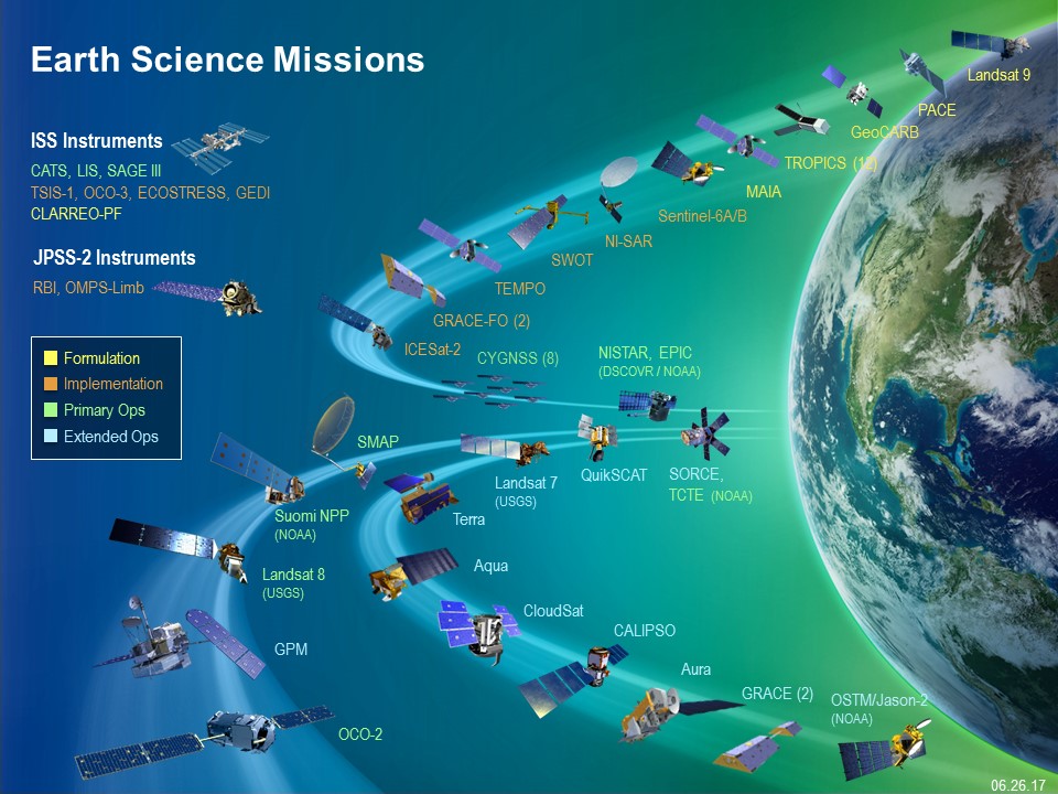
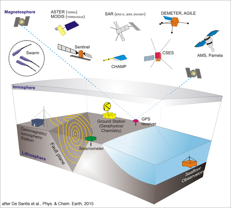
Our planet is changing on all spatial and temporal scales and studying the Earth as a complex system is essential in understanding the causes and consequences of climate change and other global environmental concerns. The purpose of Earth Science Research and Analysis Program is to advance our scientific understanding of Earth as a system and its response to natural and human-induced changes and to improve our ability to predict climate, weather, and natural hazards. These components involve multiple, complex, and coupled processes that occur on a continuum of spatial and temporal scales and affect climate, air quality, water resources, biodiversity, and other features that allow our Earth to sustain life and society.The Earth monitoring missions are designed to improve our understanding of Earth and use cutting-edge space technologies to learn more about the interactions between the atmosphere, biosphere, hydrosphere, cryosphere. These integrated systems collecte and integrate data from satellite, aircraft, and ground or underground sensors and are part of international collaboration, like
the NASA missions such as the Terrestrial Observation and Prediction System (TOPS)
 or
or
the ESA mission
such as Copernicus
Sentinel1 Sentinel2 Sentinel3
Lab. Activity1 A view from above
Lab. Activity 2 Read the document
Download your images from Copernicus Open Access Hub
Analyze them using Sentinel Application Platform (SNAP)
Earth monitoring - students level K 8 -10
Goals
- learn how our planet is constantly monitored by integrated systems which collecte and integrate data from satellite, aircraft, and ground or underground sensors .
- learn how satellite images obtained at different wavelengths help to identify Earth surface features
-learn basic analytical procedures and apply them to imagery data
Subject
Earth Science, Physics
Students age
14-16 y
Description
Activity1:
Students should define a climate problem that they would like to investigate, based on questions that arise from their school studies and from observations in their local environment. Students will have to plan their investigation of the problem, including data collection and, if applicable, data comparison from different sources. Then they should propose possible actions to help reduce the identified climate problem
Activity2:
Students will collect, analyse and compare data to draw a conclusion about the problem they are investigating. Such data can either be satellite or ground-based data retrieved from professional sources, or data obtained from measurements by the students, or a combination of them.
Acquired by Middle school students) which is a NASA educational outreach
program that enables students, teachers, and the public to learn about Earth from
the unique perspective of space.